
RF Space Monitor
Track satellites, map ground stations, and monitor live deep-space communications on an interactive 3D globe. Real-time orbital data, RF signal analysis, and spectrum intelligence, all in your browser.
Everything in One View
RF Space Monitor combines real-time satellite tracking, RF signal intelligence, ground station mapping, and live communications data into a single interactive experience.
Track 7,600+ satellites across 16 constellation groups using the same SGP4 orbital propagation algorithm used by NORAD. Positions update every second with sub-kilometer accuracy.
Map NASA Deep Space Network complexes, radio telescopes, ESA ESTRACK stations, Starlink gateways, and commercial teleports. Click any station to see antennas, bands, and live status.
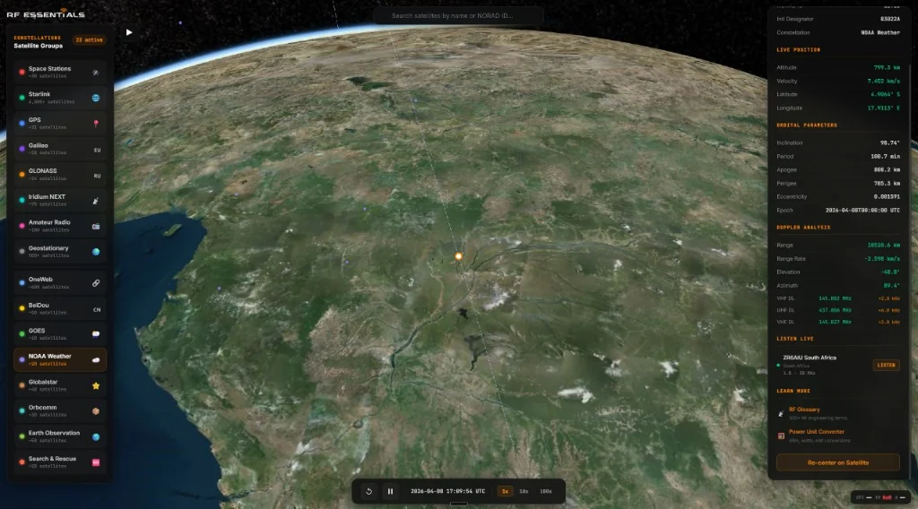
View downlink and uplink frequencies, band designations, modulation types, and real-time Doppler-shifted receive frequencies based on your location.
See full orbital paths as glowing polylines through space, ground track projections on the Earth's surface, and instantaneous radio coverage footprints.
When a satellite with a known downlink is selected, the system finds WebSDR receivers within the satellite's coverage area and links directly to a live audio stream.
Live Solar Flux Index, geomagnetic Kp index, and solar wind data from NOAA. Color-coded severity indicators show how ionospheric conditions affect RF propagation.
NASA Deep Space Network, Live
RF Space Monitor pulls real-time data from NASA's DSN Now feed every 15 seconds. You can see exactly which spacecraft each 70-meter and 34-meter antenna at Goldstone, Madrid, and Canberra is communicating with right now.
The detail panel shows each dish's active link: spacecraft name, frequency band (S, X, Ka), data rate, deep-space range, and signal direction. Active antennas glow green on the globe with a pulsing indicator. Idle dishes are dimmed.
This is the same data feed used by NASA's own DSN Now visualization, proxied through Cloudflare for reliability.
See it live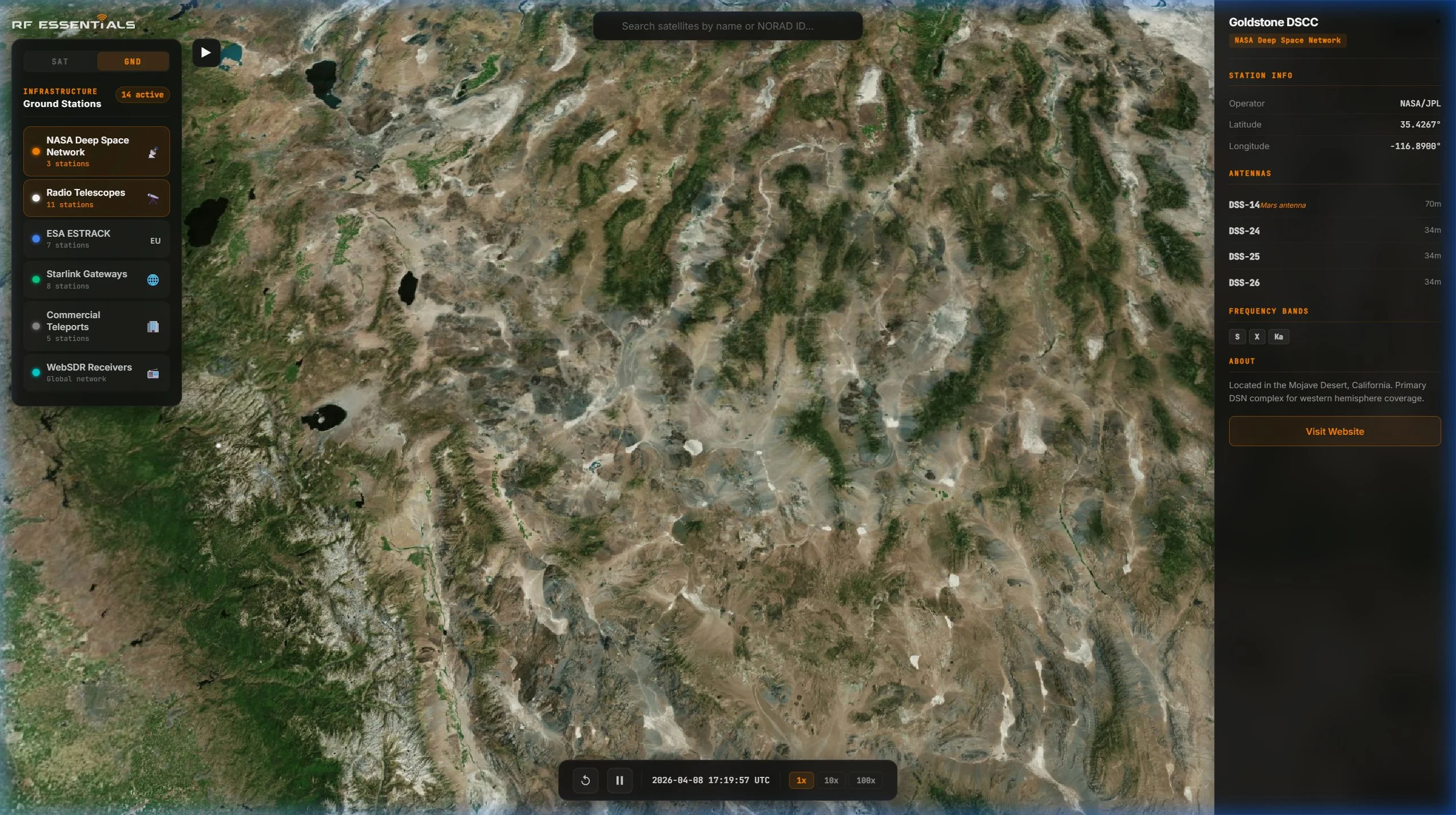
16 Constellation Groups
Toggle individual constellations on and off. From the handful of crewed space stations to six thousand Starlink satellites, every object is computed and rendered independently.
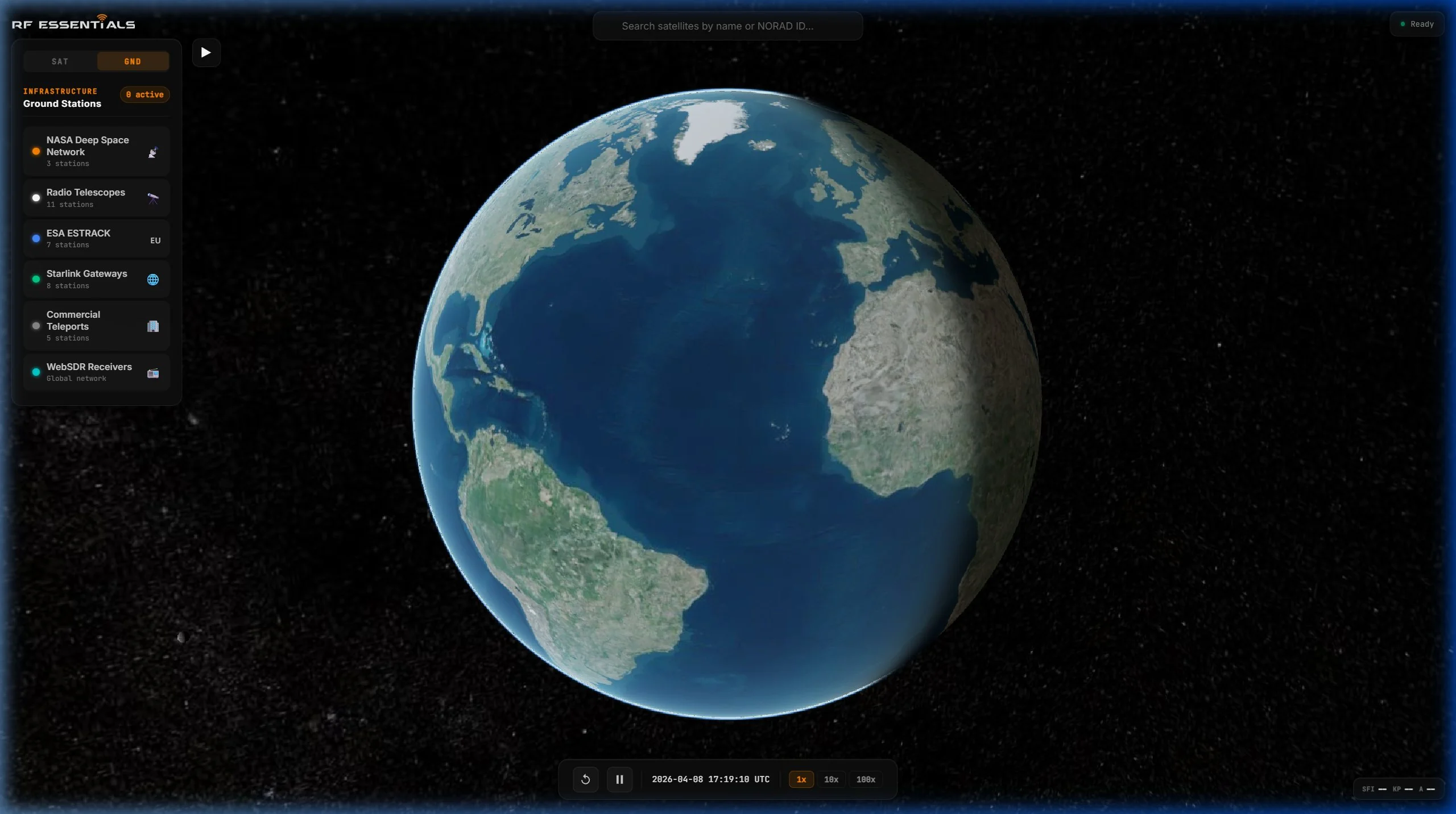
6 Ground Station Categories
Switch from satellite mode to ground station mode and map the Earth's RF infrastructure. Every station is clickable with full antenna inventories, frequency bands, and operational details.
Powered by Production-Grade Technology
RF Space Monitor runs entirely in your browser. No plugins, no downloads, no accounts. It uses the same orbital mechanics and rendering technology that powers professional satellite operations tools.
RF Analysis Built In
Select any satellite with a known radio frequency and the detail panel shows every uplink and downlink: frequency in MHz, band designation, modulation type, and whether the channel is active.
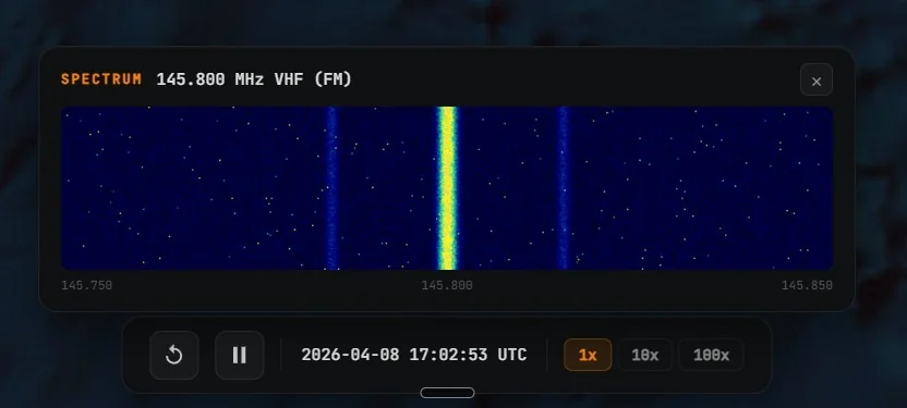
If you grant browser geolocation access, the tool computes real-time Doppler-shifted receive frequencies, your range to the satellite, elevation angle, and azimuth. A spectrum waterfall visualization shows a scrolling display centered on the satellite's primary downlink.
Every interaction links to relevant articles and calculators in the RF Essentials Knowledge Base, including path loss, link budget, VSWR, and noise figure tools.
Try it now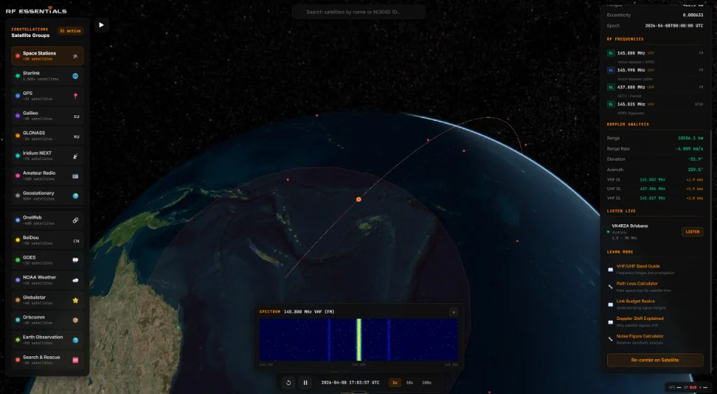
Built for the RF Community
Quickly reference orbital parameters, frequency assignments, and ground station coverage for any active satellite. Use Doppler calculations for link planning without leaving the browser.
Track amateur satellites and CubeSats in real time. Get Doppler-shifted receive frequencies for your station, see which WebSDR receivers are within a satellite's footprint, and listen live.
Visualize orbital mechanics in three dimensions. Explore how frequency bands, modulation types, and propagation work in the real world. Context-aware links to educational resources in every panel.
Launch RF Space Monitor
Open the interactive 3D globe and start tracking satellites and ground stations right now. Works on any modern browser.
Open RF Space Monitor